
Map-Making Services
I make maps - all kinds. If you needs something mapped and/or printed, feel free to send me an email.
These are some example maps below. Click on the images for a high-res view of each one.
I also love to navigate with a just a map and compass, and I enjoy teaching people to navigate. I wrote the book Squiggly Lines to help out beginning navigators and adventure racers get better at it.
I also sell Moscow compasses.
I also love to navigate with a just a map and compass, and I enjoy teaching people to navigate. I wrote the book Squiggly Lines to help out beginning navigators and adventure racers get better at it.
I also sell Moscow compasses.
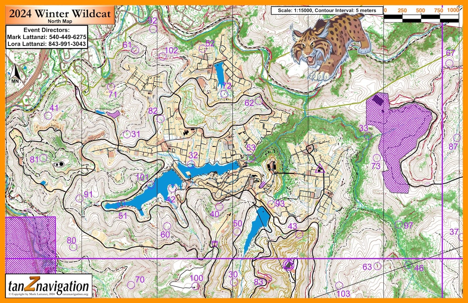 |
A 1:15000 map for the 2024 Winter Wildcat rogaine. Lots of extra details as I've been updating this map every time we have an event at SBR. |
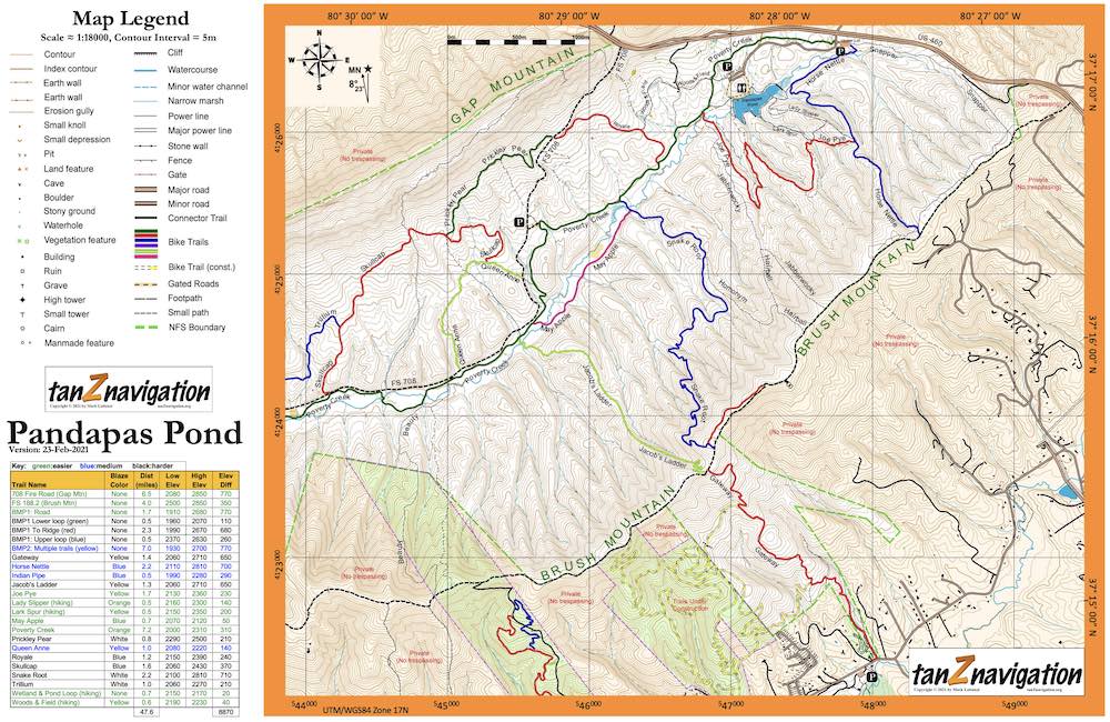 |
A 1:18000 double-sided hiking/cycling map of the Pandapas Pond and Brush Mountain trail systems. |
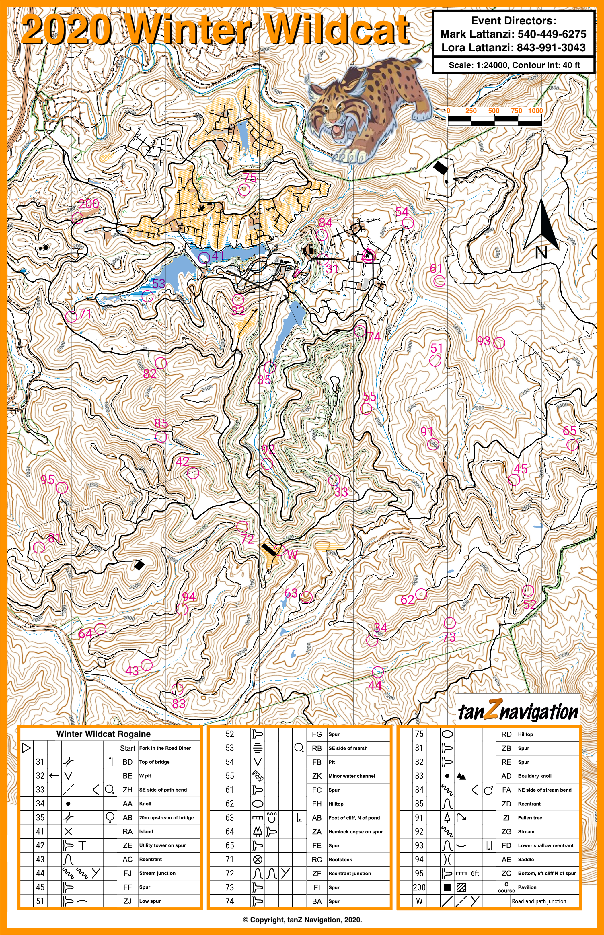 |
A 1:24000 map for the 2020 Winter Wildcat rogaine, generated from LiDAR data, water resource data, and Open Street Map, as well as some custom GPS tracks. |
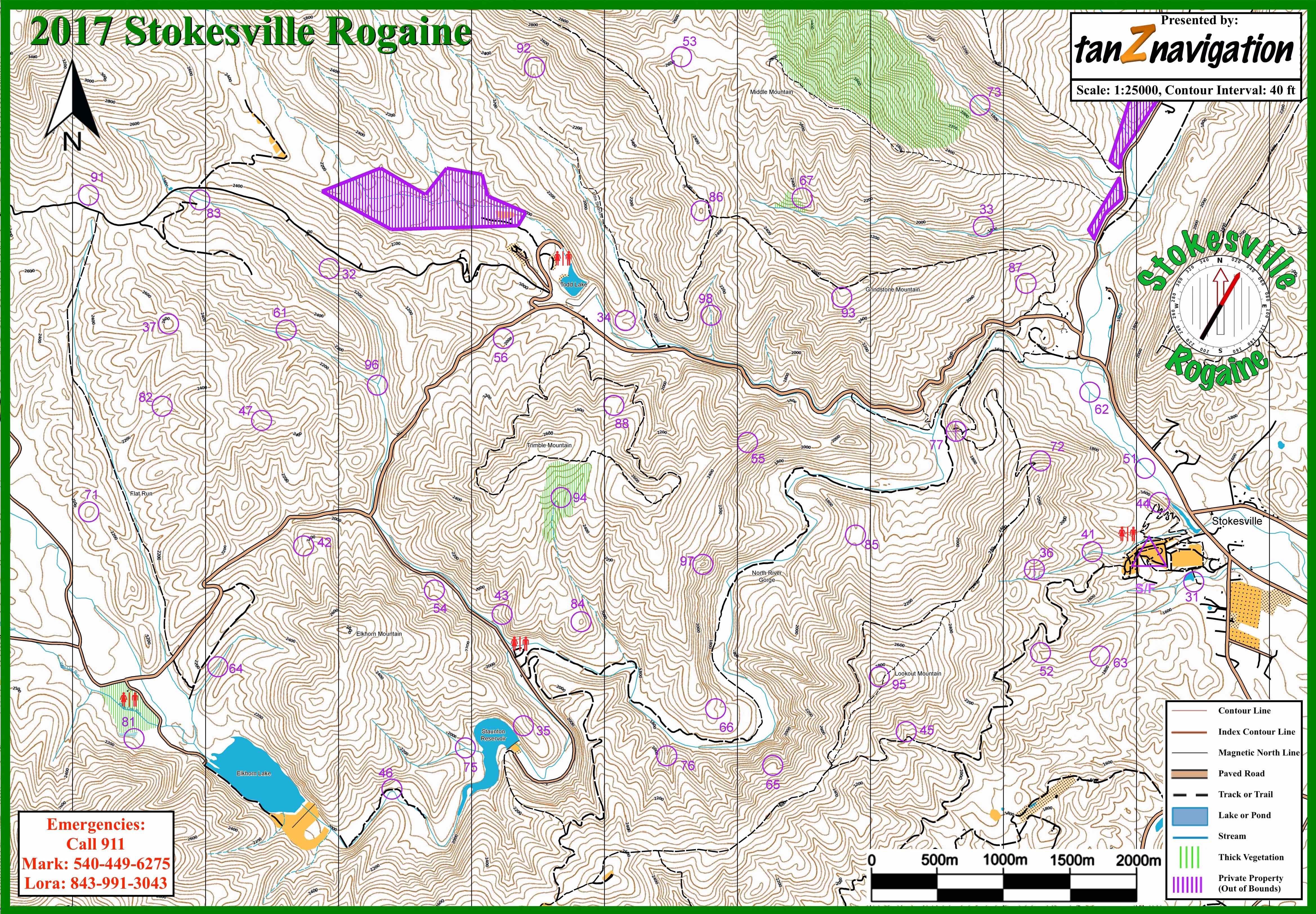 |
A 1:24000 map for the 2017 Stokesville rogaine, generated from LiDAR data, water resource data, and Open Street Map, as well as some custom GPS tracks. |
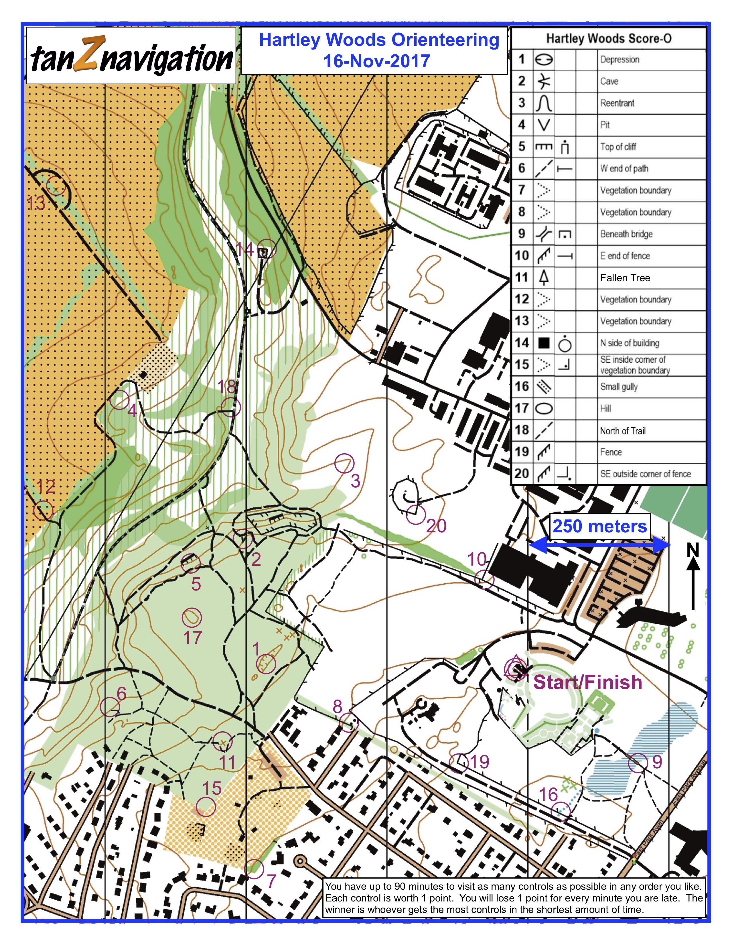 |
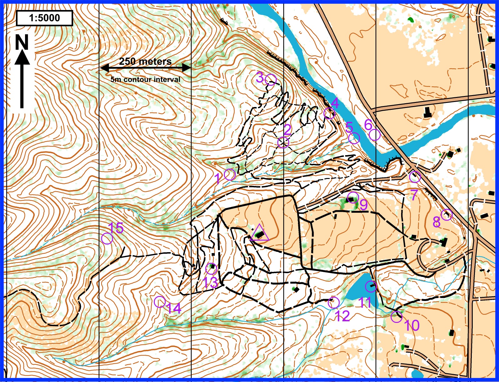
A 1:7500 map for HVOC orienteering event, made from DEM models and Open Street Map data. |
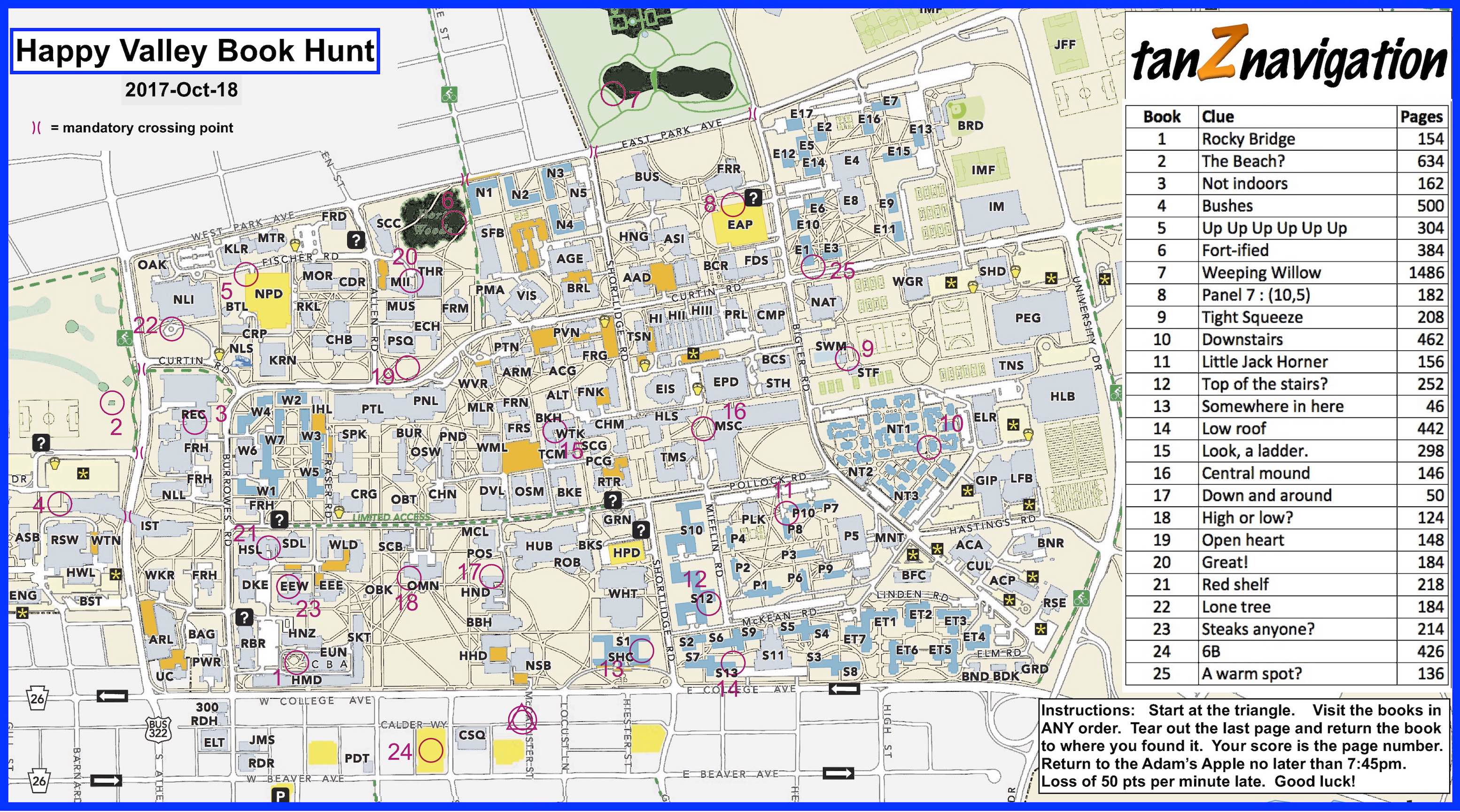 |
A 1:10000 map for HVOC Fall book hunt on the Penn State campus. |
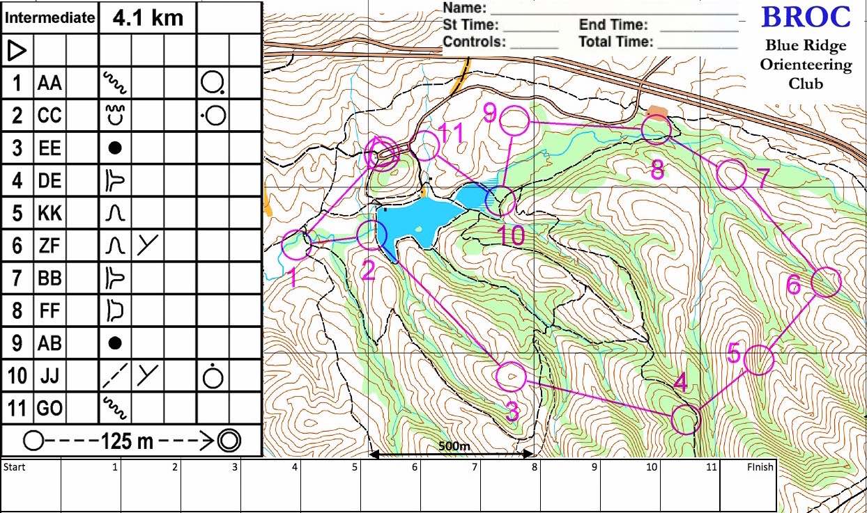 |
A 1:15000 map for a BROC orienteering event at Pandapas Pond. |
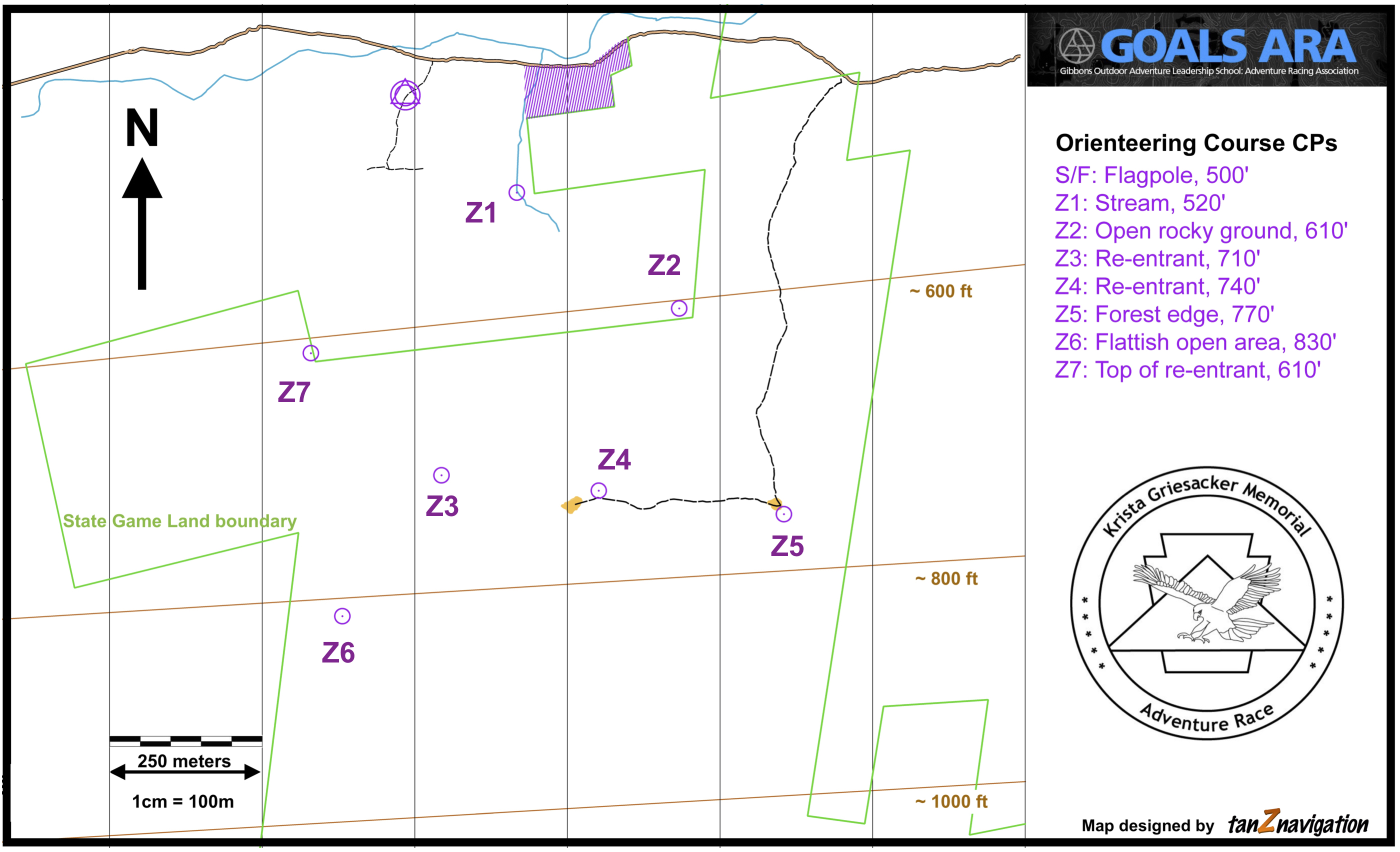 |
A unique map with no contours lines for the Krista Griedacker Adventure Race. |
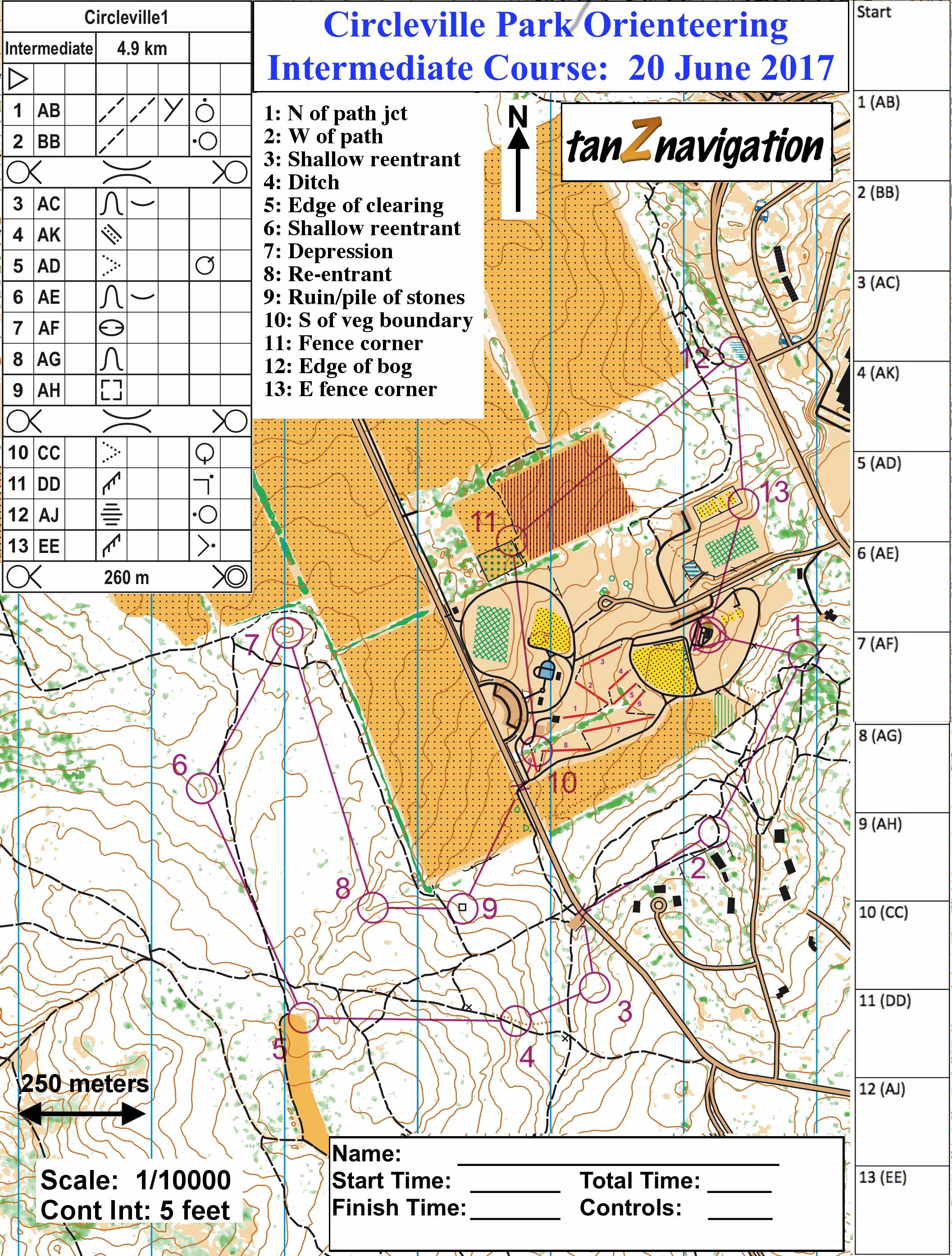 |
1:10000 map of the Scotia Game lands for a HVOC orienteering meet |
 |
1:5000 map of the Stokesville campground for the Stokesvile rogaines |
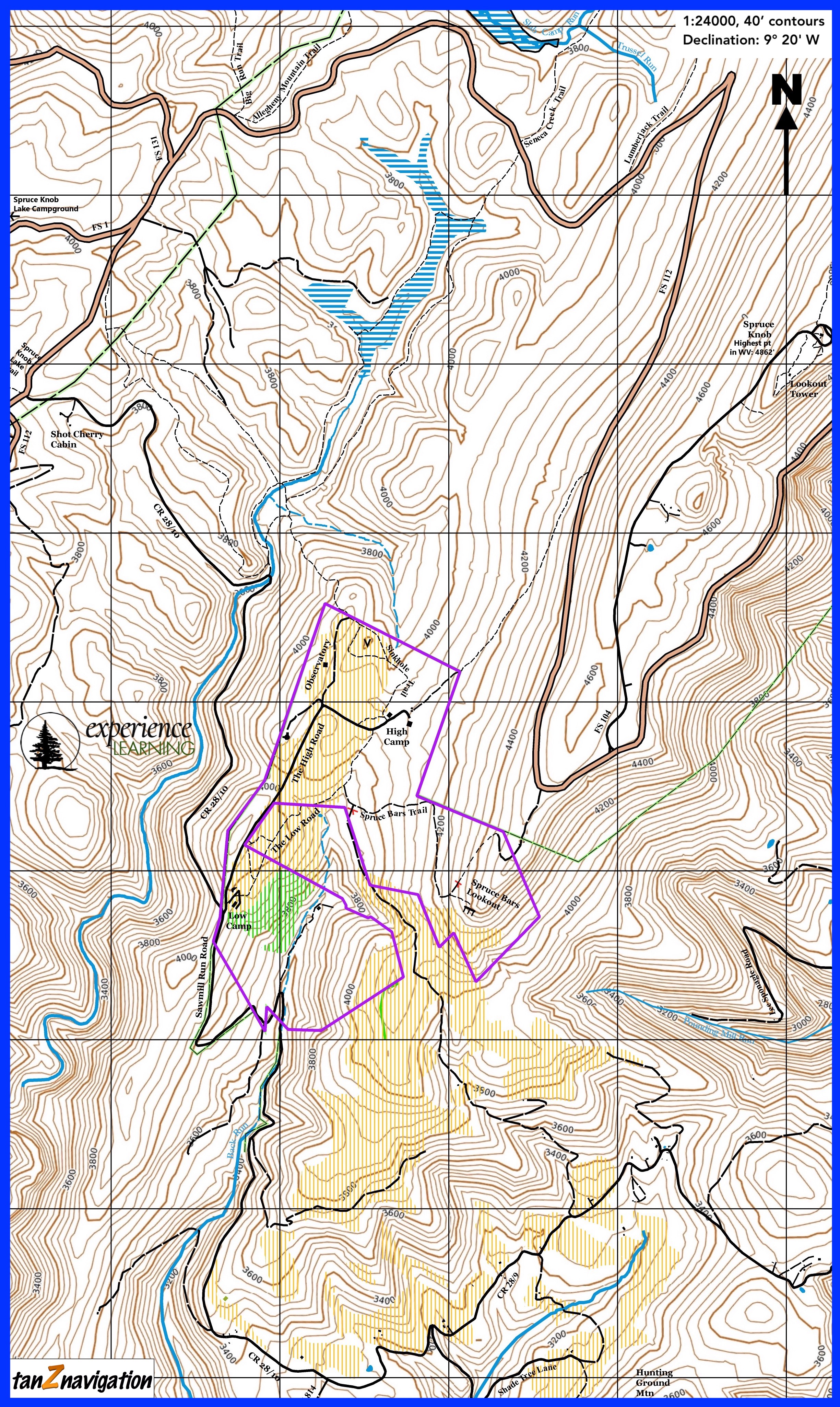 |
A property/trail map for the Experience Learning Institute on Spruce Knob, WV. |
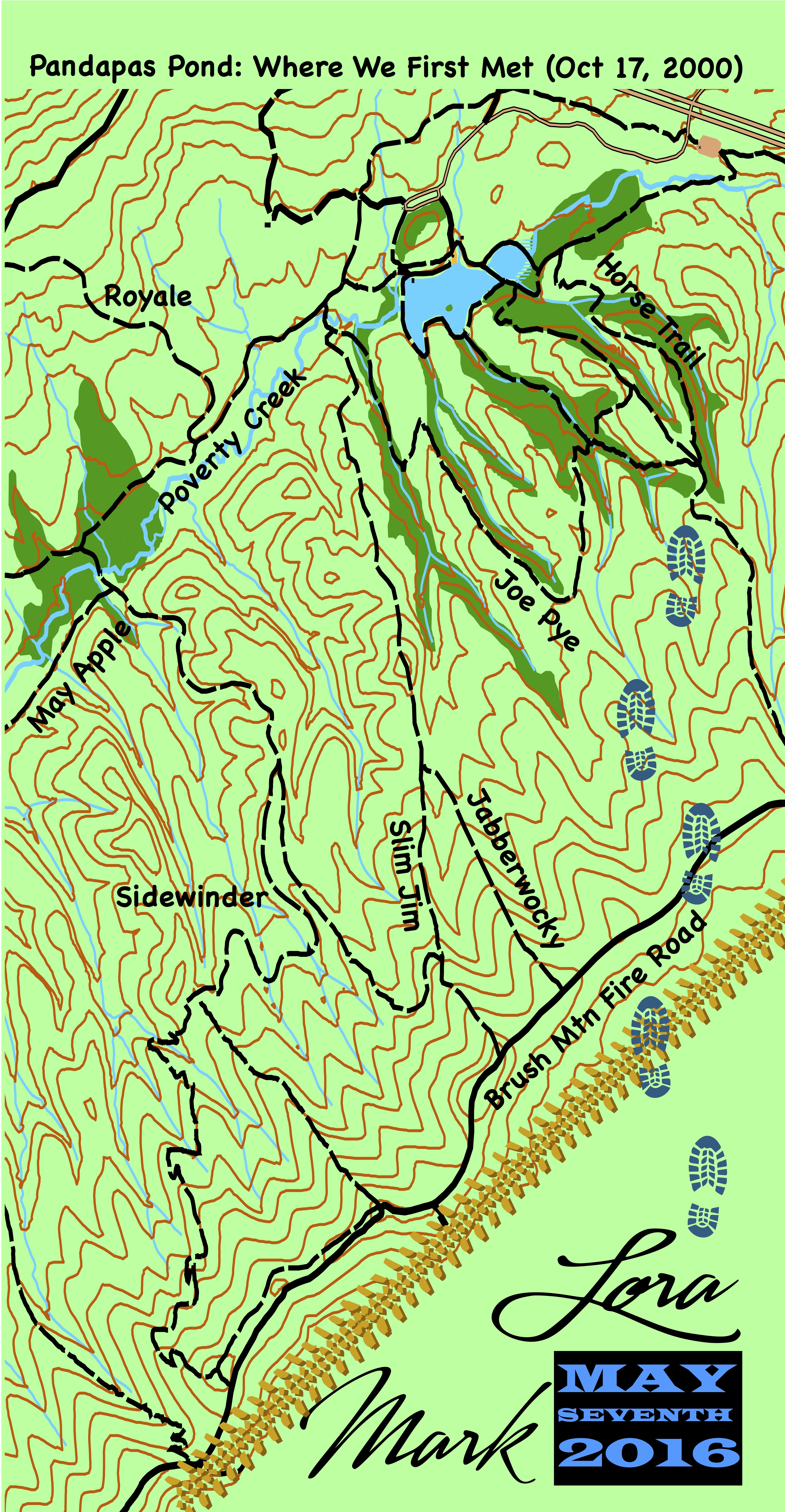 |
A stylized map of Pandapas Pond made into a buff for Mark/Lora wedding guests |